Europan 10 design competition
Triel-sur-Seine, Ile-de-France Region, France
Michael Hackspill, Shu Chen, Katayoun Amid architects ● Date of competition: June 2009
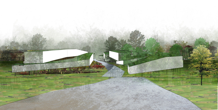
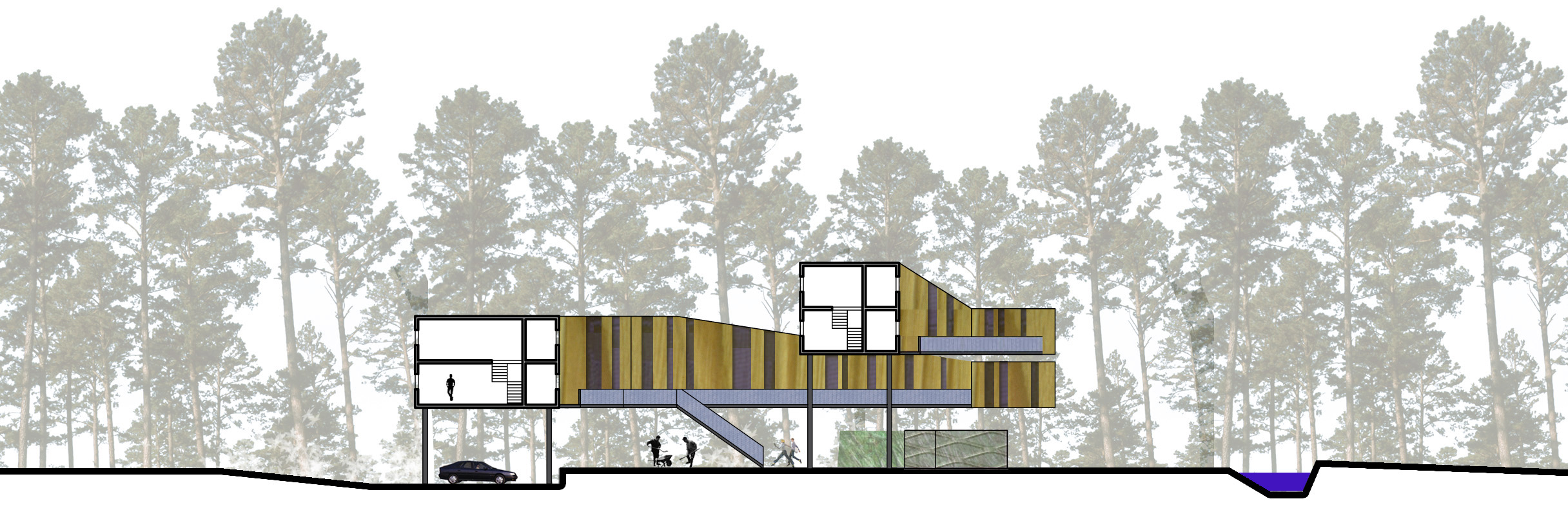
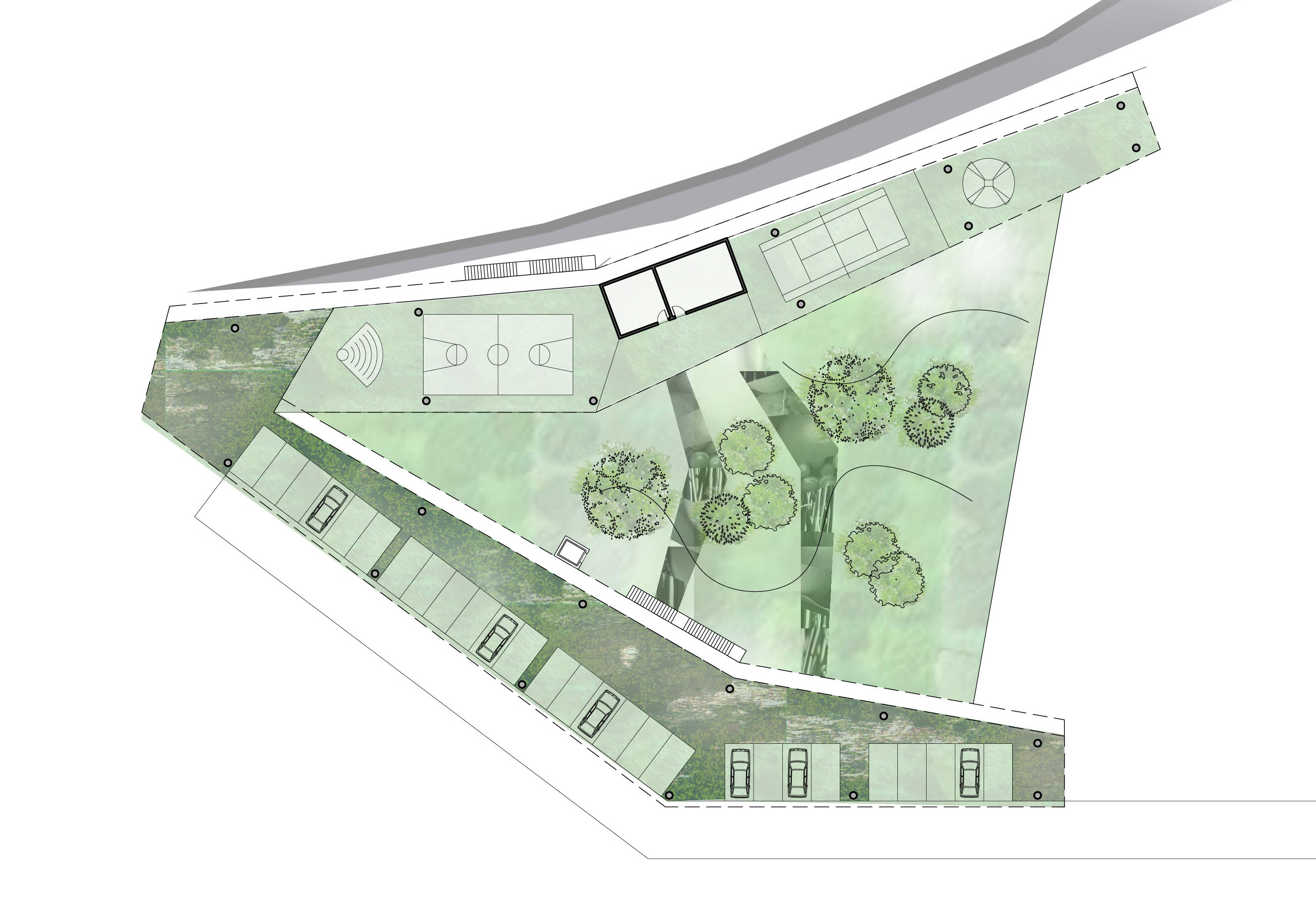
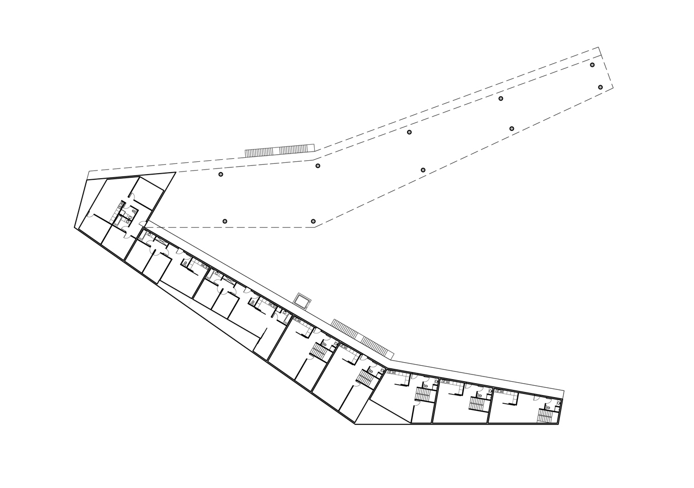
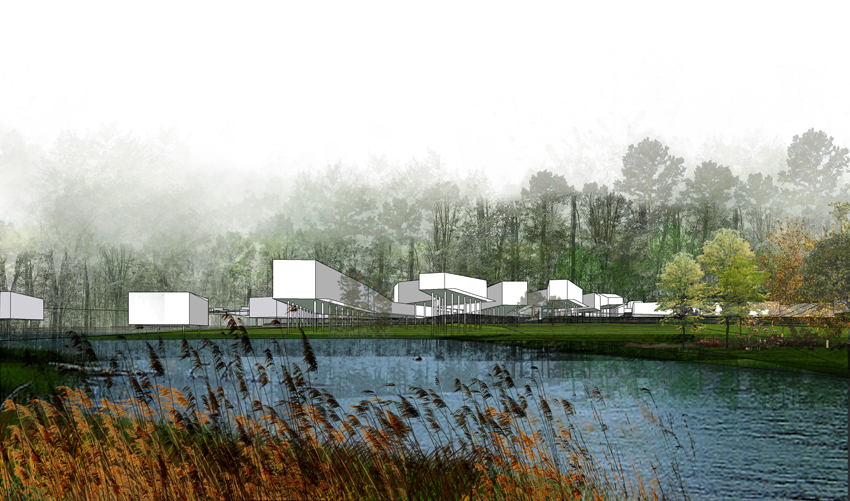
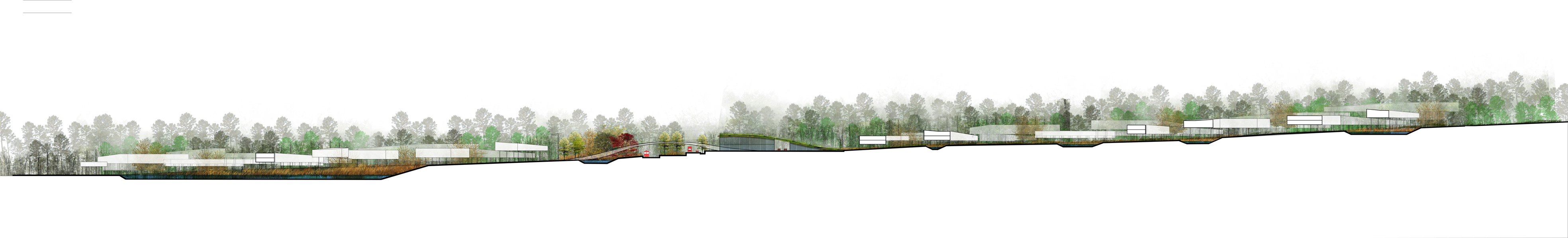
Between Triel-sur-Seine to the west and Chanteloup-les-Vignes to the east, the site opens onto forest of Hautil to the north, and overlooks the Seine valley to the south. The river and the forest constitute the two natural beauties that we propose to gather by means of an inhabited landscape which forms the communal «lung» of the two towns, and at the heart of which the buildings lightly weave, crossed by a natural breeze. The trees colonize the whole territory, interspersed with clearings, and streams that irrigate the soil. The dwellings on stilts free up the ground and float on the foliage, folding along the slope, and intertwining. The buildings form the edges of the clearings, which accommodate the inhabitants’ communal activities, including landscaped parking lots, playgrounds, and vegetable gardens. All the living spaces are facing south-west, and benefit from unobstructed view of the valley. On the other side, the passageways giving access to the housing follow the north-east facades which shelter utility rooms. This orientation encourages energy saving. The clearings, like corollas, are traversed, from north to south, by three structuring minerals
lanes, that slide down the slope of the land, rise above roads and railways, thus linking the two new planned areas, then curving to the south between the existing landscaped lines. Along these ways, the larger landscape of the Seine valley is revealed. The streams, like planted ditches, follow them,
while draining storm water and gray water from the foot of the buildings, then gathering to form a network that pour into lakes inserted in the middle of the two planned parks. The first one, linear, is created in an existing preserved natural space, which forms an acoustic and visual filter in front of
the pollutants of the railways and the thoroughfare. The second one, created on the southern edge, is a public space for leisure activities that flares through the valley, in the heart of the newly planned forest and the residential blocks. The lakes are retention and filtering ponds: aquatic plants (reeds, bulrushes, water lilies, and lotus) purify the water and foster biodiversity. Water is then reused for the watering of the kitchen gardens. The buildings for professional environmental activities are anchored to the ground, their green roofs emerge and raise softly, following the sloping ground, along the thoroughfare and the railway. They also form an acoustic filter for the residential blocks, while forging the new identity of the place. The new exhibition hall also forms an emblem next to the traffic circle. A network of pedestrian walkways place themselves into existing farming alleys, from east to west, connecting the two towns by way of crossing the parks and the clearings. The project strengthens the natural beauty of the territory : the new forest that prolongs the forest of Hautil, the parks, the planted ditches and the lakes, the mineral ways that irrigate the residential
corollas along the line of slope, the panoramic views of the Seine Valley, form as many as landscaped levels that merge to receive an eco-aware living environment.
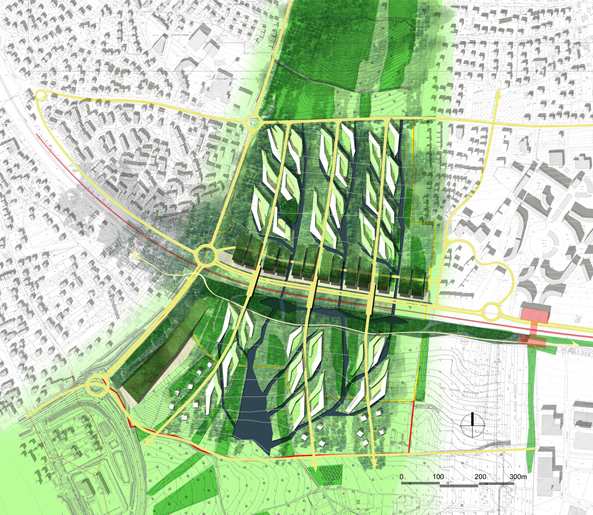
The landscaping management of the territory: a living environment open onto the nature through the continuous forest and streams: the green lines
planned to the north and to the south strengthen the natural forces of the site, and follow the network of streams; the central park oriented in an east-west direction is an existing preserved natural space which forms an acoustic and visual filter in front of the pollutants of the railways and the thoroughfare ; the south lake is a filtering water tank into which streams pour, and a public space for leisure activities; streams are planted ditches which follow the natural line of slope and drain the the gray water and the storm water coming from the roofs of buildings.
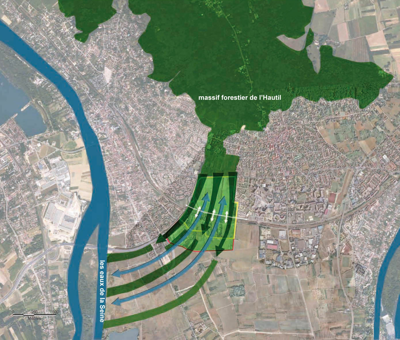
The two natural beauties of the territory, the Forest and the River, are
gathered together: the trees colonize the whole area, as an extension of the
forest of Hautil, streams irrigate the soil through the Seine.
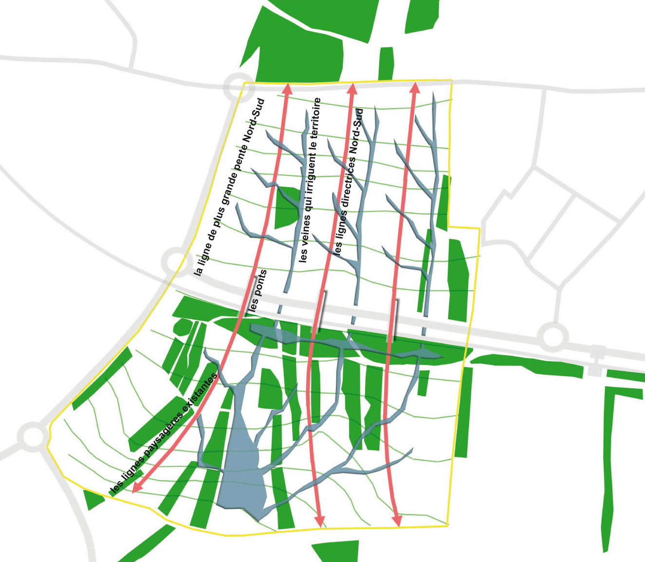
The main elements of the site are traced in a natural mouvement along the
line of slope: the structuring lines, oriented from north to south, link the new planned areas, span the thoroughfare and the railway, and curve to the south between the existing landscaped lines ; the planted ditches drain storm water and gray water, and pour into the lake.
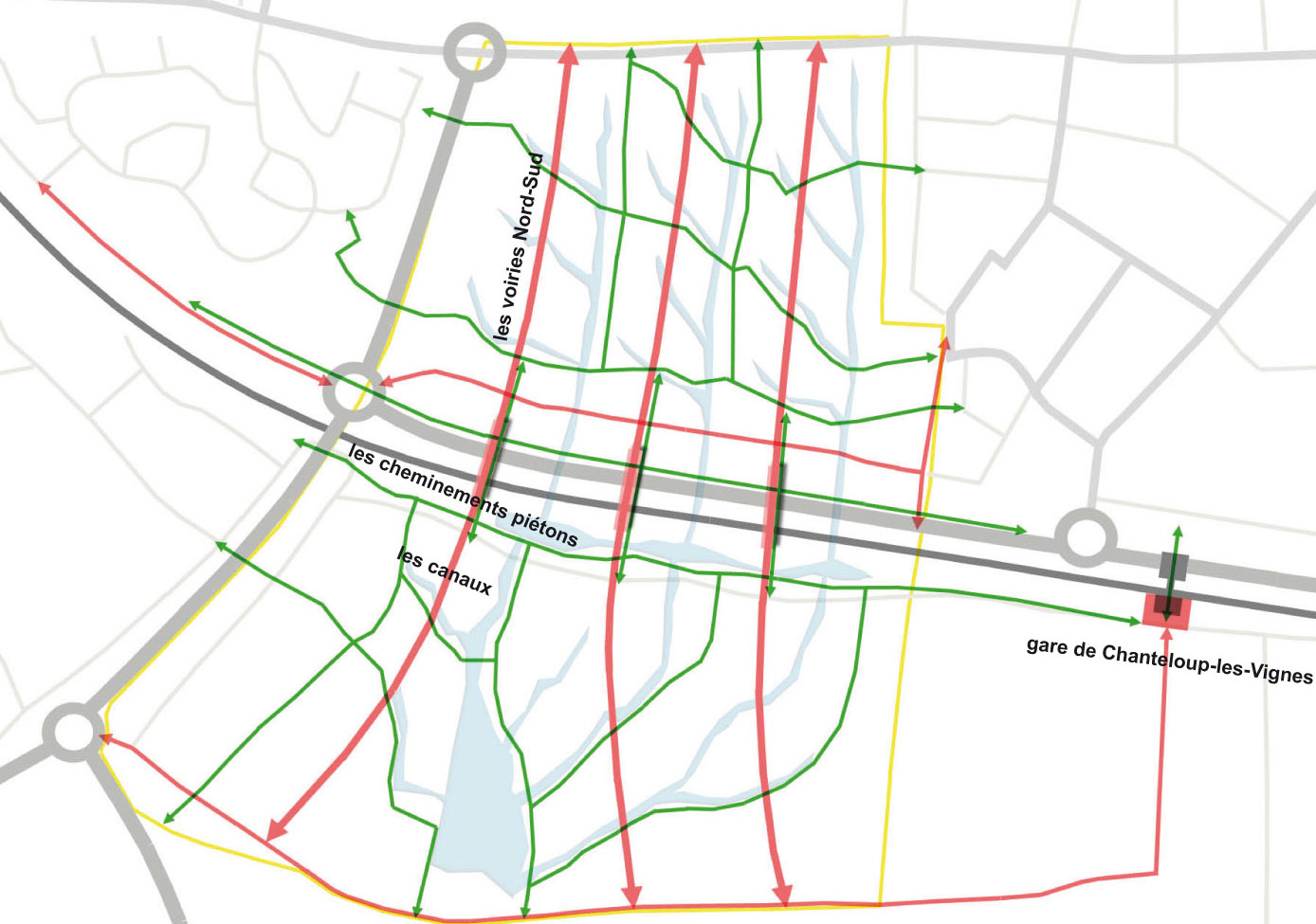
The urban network: the roads connect the residential blocks from north to south; the pedestrian pathways link the existing neighborhood from east to west and the new planned housing from north to south alongside the streams.
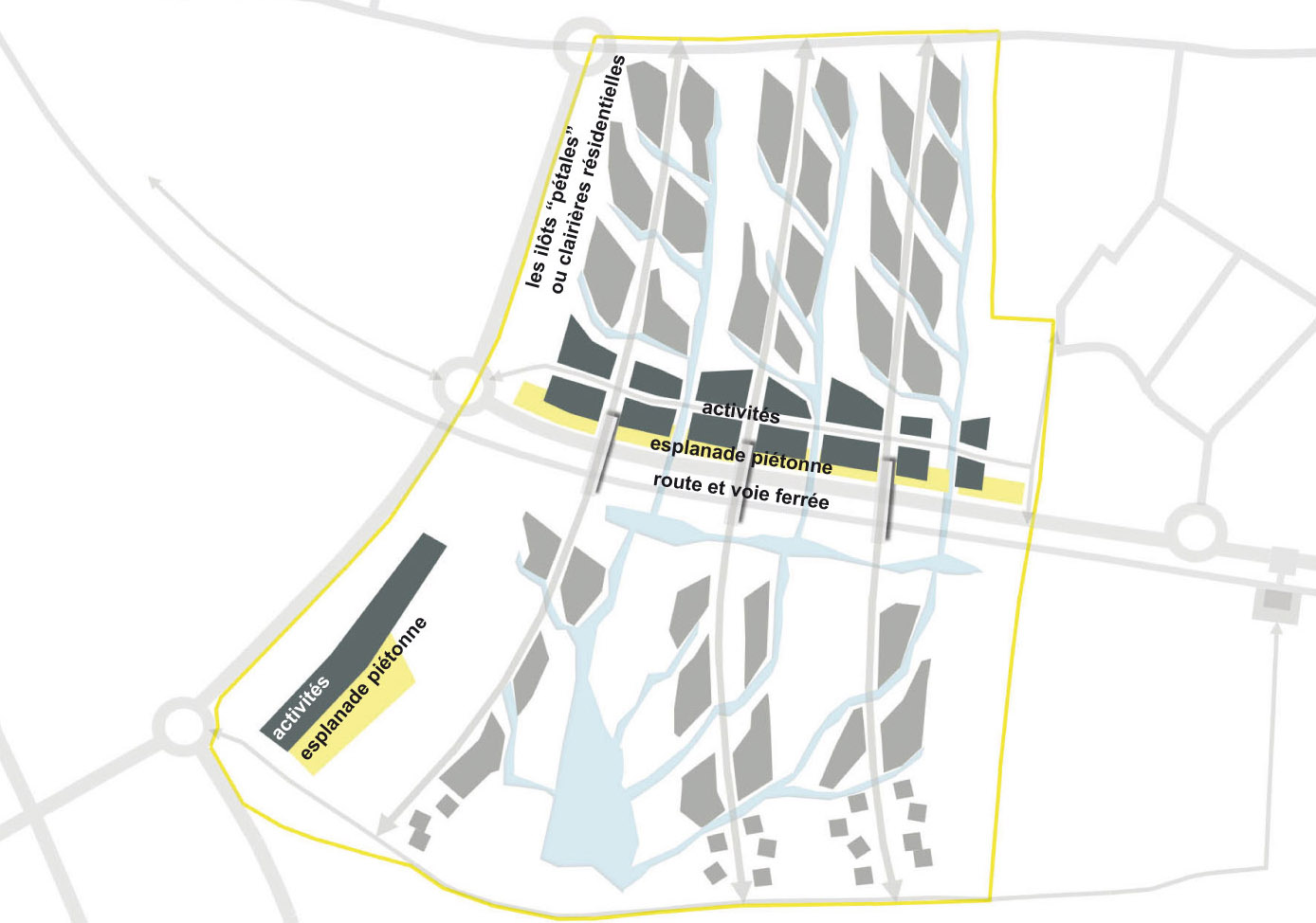
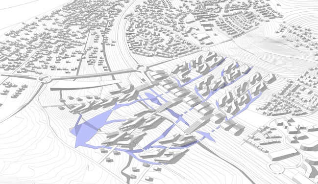
The plot plans are structured in corollas which petals forming clusters of
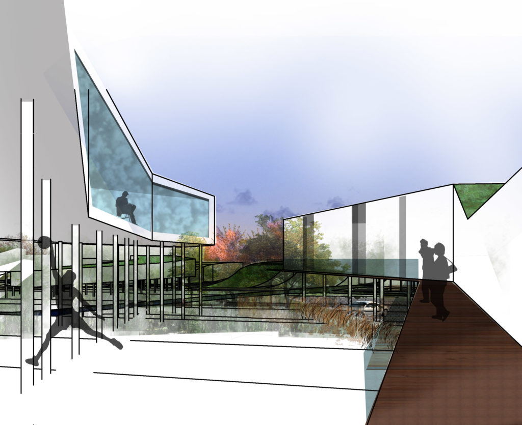
housing: the housing (petals) grows along the north-south roads which irrigate the urban corollas, and form clearings blocks in the heart of the forest; living spaces are oriented to the south-west to priviledge panoramic views of the Seine valley and energy saving; the buildings for professional environmental activities are set up along the thoroughfare and the railway to form an acoustic filter for the residential blocks, while forging the new identity of the place.